
Causey Pike - Lake District Walk
Friday 13th September 2013
Not sure how my heels would stand up to a walk of this length and ascent we decided to make it an out and back route via the valley path in order to ensure that should the need arise I could easily turn back. Thankfully my heels were fine and we were able to enjoy the walk we set out to do.
Start: Stoneycroft (NY 2326 2170)
Route: Stoneycroft - Stoneycroft Gill path - High Moss - Causey Pike (375) - Scar Crags (376) - High Moss - Stoneycroft
Distance: 6 miles Ascent: 598 metres Time Taken: 4 hours 35 mins
Terrain: Clear paths.
Weather: Grey but warm.
Pub Visited: Banks Tavern, Keswick Ale Drunk: Jennings Cumberland

Setting off around midday we had hoped for a brighter day then this.
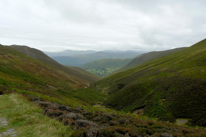
We made surprisingly quick time up the valley path.

Looking across Stile End and Barrow we were hopeful that it might be starting to brighten up.

As we reached the col between Causey Pike and Scar Crags the cloud was dropping onto the summit of Sail.

Heading for Causey Pike's summit and the cloud seems to be descending onto the higher fells around us.

Looking towards Dale Head from the summit.

Ard Crags and Robinson from the summit.

For one brief moment the sun broke through and suddenly everyone on the summit was being harassed by insects.

We left the summit to the insects and made our way back towards Scar Crags.

Looking back to Causey Pike, with the distant fells now completely lost in low cloud.

In the opposite direction things seems to be brightening up.

Scar Crag's summit.

A path I hope to never walk again unless the path fairies slab it. Too much of a reminder of the conditions on which I broke my leg.

Walking back down the valley path we are rewarded with views of Derwent Water.
All pictures copyright © Peak Walker 2006-2023