
The Edges - Peak District Walk
Wednesday 4th January 2017
A dry sunny day was forecast so we headed out to do the edges. We had hoped that now the schools were back the edges might be quite quiet but they were the busiest I have seen them for a long time; it appears everyone had the same idea as us and waited for everyone else to go back to work/school before going for a walk.
Start: Curbar Gap car park (SK 2623 7470)
Route: Curbar Gap car park - White Edge - White Edge Moor - Wooden Pole - Longshaw Estate - Hay Wood - Froggatt Edge - Curbar Edge - Curbar Gap car park
Distance: 8.25 miles Ascent: 298 metres Time Taken: 4 hours 5 mins
Terrain: Clear paths but plenty of bog hopping required.
Weather: Dry, sunny and cold.
Pub Visited: The Wheatsheaf Hotel, Baslow Ale Drunk: Thwaites Wainwright

Heading towards White Edge and there are certainly plenty of people about.

After a muddy climb we reach the start of the edge and pause to take in the view we will soon loose of Eaglestone Flat and Baslow Edge.
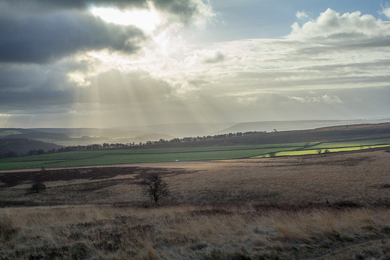
Signs that the sun, as the weathermen promised, is about to break through the clouds.

We has delayed setting off along the edge in the hope the group now gathering at the trig point would get well ahead of us.

The sun starts to light up the dying bracken on Stoke Flat.

As luck would have it we caught up with the group at the one point on the edge where the path is narrow and passing them required clambering above them in the heather.

A task made all the more awkward by the fact they now stopped on mass whilst someone described the scene in front of them. For the record they were admiring Win Hill and Bamford Edge

Looking along White Edge and Big Moor, our route would take us just beyond the trees on the horizon.

Higger Tor comes into view as we drop down from the highest point of the edge.

Mag Clough and William Hill across Stoke Flat.

Mother's Cap to the left of Higger Tor comes into view.

Approaching the end of White Edge.

Lose Hill and Kinder can now be seen.

We had lunch sat in the grass on White Edge Moor, making the most of the sunshine whilst looking across to Totley Moss.

As we enter Longshaw the view across Lawrence Field now includes all of the Great Ridge.

The view also incudes Eyam and Offerton Moors.

This area is named after this rather unremarkable wooden pole. The original
Wooden Pole may have been a guide stoop, an alternative theory
is that it marks the boundary of the parish of Totley.

We follow the broad tracks through Longshaw.

On this part of the route we still get to enjoy the views across to Kinder.

After the mud and bog hopping we enjoyed along White Edge the going is now somewhat easier.

Carl Walk and Higger Tor from close to Longshaw Lodge.

One of the Companion Stones that can be found near the former Guide Stoops.

This particular stone's inscription is called Walk On.

Once we were on Froggatt Edge the setting sun was in our eyes. I took the opportunity to have a go at creating a starburst.

At this time of year it is possible to make out all of the Stone Circle on Froggatt Edge.

Looking back to Bamford Edge.

The Derwent Valley as we approach Curbar Edge.

The sun lights up Stoke Flat.

White Edge and Stoke Flat from the short climb onto Curbar Edge

Baslow Edge form Curbar Edge as the sun starts to drop below the horizon.
All pictures copyright © Peak Walker 2006-2023