
Haddington Hill
Height 267metres
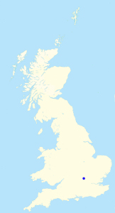
Grid Reference SP 891 091
Area
County Top - Buckinghamshire
Marilyn - Region 39: Central & Eastern England
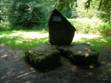
The stone that marks the county of Buckinghamshire.
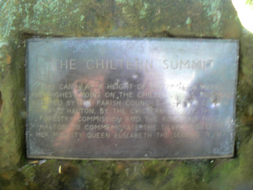
As the plaque shows it is also the highest point of the Chiltern Hills
Wendover Woods - Haddington Hill (CT) - Aston Hill (TP) - Buckland Hoo - Fox Lane - Pavis Wood (CT) - Ridgeway - Wendover Woods
All pictures copyright © Peak Walker 2006-2021