
Bolehill East
Grid Reference: SK 29385 55352
Flush Bracket Number: S1716
Type: Pillar
Built: 23rd February 1937
Historic Use: Secondary
Current Use: None
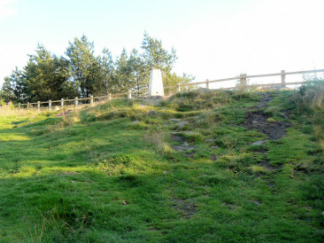
Approaching Bolehill's trig point from Black Rocks.
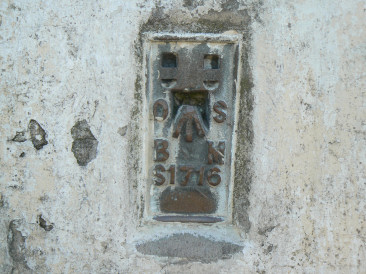
Bolehill East's Flush Bracket.
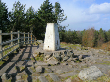
Bolehill's trig point.
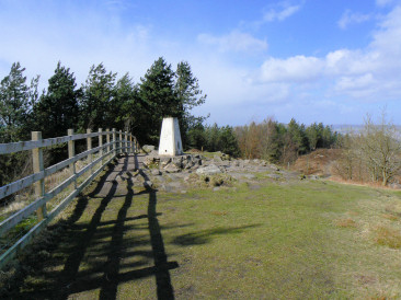
Bolehill's trig from the Bolehill path.
Cromford Wharf car park - Cromford Canal - Birch Wood - Wigwellnook Farm - Cromford Moor (TP) - Black Rocks - High Peak Trail - Cromford - Cromford Wharf car park
High Peak Junction - Birch Wood - Bolehill (TP) - Big Plantation - High Peak Trail - High Peak Junction
High Peak Junction - Cromford Canal - Birch Wood - Bolehill (TP) - Black Rocks - High Peak Trail - High Peak Junction
High Peak Junction - High Peak Trail - Black Rocks - Bolehill (TP) - Big Plantation - High Peak Trail - High Peak Junction
Carsington Water - Carsington - Hopton - Wirksworth - Bolehill (TP) - Black Rocks - High Peak Trail (Middleton Top) - Carsington Pasture - Carsington - Carsington Water
All pictures copyright © Peak Walker 2006-2023