
Selside Brow
Grid Reference: NY 47800 09970
Flush Bracket Number: N/A
Type: Concrete Ring
Built: 1st June 1961
Historic Use: Third Order
Current Use: None
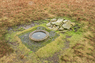
The sunken trig point on the summit of Branstree.
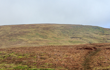
Looking towards Branstree from High Howes.
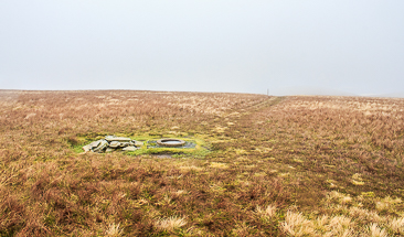
Branstree's summit lost in the cloud.
Lay-by Haweswater Road - Corpse Road - Brown Howe - Mardale (394) - Selside Pike (395) - High Howes - Mardale (396) - Branstree (397) - Gatescarth Pass - Mardale Head - Lay-by Haweswater Road
All pictures copyright © Peak Walker 2006-2021