
High Wheeldon
Grid Reference: SK 10037 66111
Flush Bracket Number: S4154
Type: Pillar
Built: 1st July 1947
Historic Use: Secondary
Current Use: None
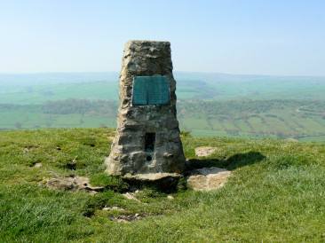
High Wheeldon's trig point, looking toward's
Top o'th' Edge
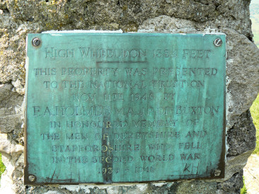
Plaque found on High Wheeldon's trig.
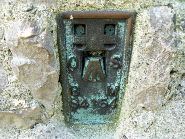
High Wheeldon's Flush Bracket.
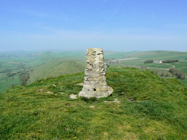
Looking towards Axe Edge and Chrome Hill
from High Wheeldon's summit.
Edale car park - Hollins Cross - Mam Tor (TP) - Rushup Edge - Brown Knoll (TP) - Kinder Scout - Grindslow Knoll - Edale car park
Longnor - Green Lane - High Wheeldon (TP) - Earl Sterndale - Dowel Dale - High Edge - Chrome Hill - Longnor
All pictures copyright © Peak Walker 2006-2021